Falling for Benton MacKaye
Aska Trail System
Early morning births excitement and anticipation for the Aska Trail System. This North Georgia trail system winds through the Chattahoochee National Forest. There are 17 miles of easy, moderate, and difficult biking and hiking trails. The trails are interconnected to accommodate longer day trips and also feature multiple trail heads for shorter hikes or bike rides, making this wilderness accessible for all adventure-seekers. We opt for parking at Stanley Gap and beginning our trek along the Stanley Gap Trail, connecting to the Benton MacKaye Trail (BMT), and eventually reaching Fall Branch Falls. Our journey was 3.62 miles round trip; however, there is a shorter 0.5-mile option to reach the scenic spot of Fall Branch Falls.

Fall Branch Falls
Stanley Gap Trail
At the cozy, vacant entrance, we immediately start traversing through the dense mixed hardwood forest along a gravel path on the Stanley Gap Trail. Strenuous climbs throughout welcome us to the North Georgia hills, an unfamiliar counterpart to our typical Florida flatland hikes. We put one foot in front of the other, intentionally moving slower as to avoid burn out at the beginning of our hike.

Stanley Gap Trail
Benton MacKaye Trail
After just a short time, we come upon where the Benton MacKaye Trail intersects, and turning right, headed southbound, we blaze along the white diamonds toward the Fall Branch Falls. The path up Rocky Mountain forms so narrow that we have to move left to right to dodge trees, following along the grassy path of switchbacks. Black dragonflies flutter around us, revealing their blue bodies in the sunlight. The rapid falls prevail in the distance. Tall flatwoods surround us, dark bark lends aromas of fresh wood and water, and lively green leaves fall along at our feet. The sunshine leaks down to the understory as we approach a rocky stairwell leading to the falls, and the light trickles on the bright green moss blanketing the falls’ borders.

Benton MacKaye Trail - the “BMT”
Fall Branch Falls
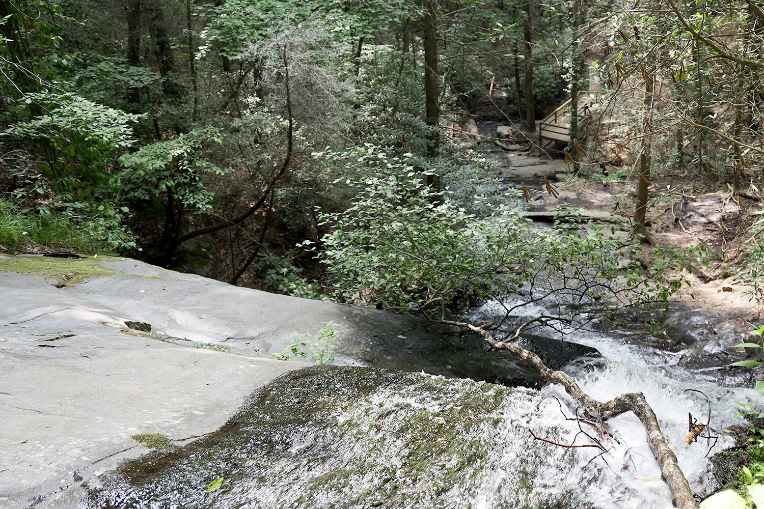
We find a spot at the top of Fall Branch Falls to perch and imbibe the beauty of crystal clear waters shimmering on the rocks, unveiling sparkling diamond-like shapes. The smaller pieces of rocks seem impenetrable, not even budging with the rough waves passing over them. Larger rock plateaus stretch over 10 feet with unsteady walkways of downed trees over the rushing waters. Roots and vines protrude, grow, and wind over the rocks, twisting in shape as if to form animal remains, with each rock plateau spilling over onto the next one. Some bare parts of the rocks are sturdy enough for us to pause at the top of the falls for awhile and breathe the fresh water smell and gaze upon the cascade drops descending down about 75 feet below to a boardwalk lookout, the only unnatural object in the space.

Fall Branch Falls
The BMT
The Benton MacKaye Trail (BMT) is a hiking and biking path that stretches 300 miles from Springer Mountain in Fannin County, Georgia to Big Creek Campground in the Great Smoky Mountains National Park. In 2013, Blue Ridge officially became the Benton MacKaye Trail town in Georgia, with downtown Blue Ridge only 3 miles from the BMT.

Explore More:
Take a hike with us in the Blue Ridge Mountains…